Cyprus — albeit a relatively small island, the villages here number in the hundreds. We’ve already visited and told you about several fascinating spots (see here in our column “Villages of Cyprus”). Still, with others of unique cultural and historical significance to one region or another — we’ve yet to get our bearings.
Many of you have probably been hearing about these spots. Especially now, in early spring: Arediou is a popular holiday destination for Nicosians at the end of the working week. Amongst its fields, Malounta, like its neighbouring village Agios Ioannis, inconspicuously preserves a “dimly remembered world”.
Arediou is our first port of call for today: along the motorway from Nicosia to Agros, turn off at the signing and head along the E903 (Griva Digeni street) joining all the villages in this direction together. Then take another turn to the left, onto the E904 (Archbishop Makarios Street), and we’re here…
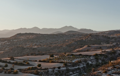
We got here when it was still morning: the weather in March is changeable, and this is no exception in Cyprus. If not one of summer heat, the day was certainly promising to be full of sunshine… this wasn’t a problem, however, for the village was very green.
Arediou
From the Greek: Αρεδιού — the village lies in the Nicosia district, 21 km from the capital or “halfway” towards Palaichori. These settlements have been known since prehistoric times, with confirmation that they were populated by immigrants from Mykonos (there is an archaeological dig on the site where they were buried). Much later, in the Lusignan era, the village was one of the possessions granted to the vassals (a fief) for their service.
Further, based on references by the Italian traveller-historian Forio Voustronio (we will come back to this name repeatedly in our accounts of Cypriot villages), the famous owner of these arable lands was the feudal lord Juan D’Arras. The village is still named after him to this day. Close to 1400 people live here today (the number of residents increases yearly with every coming summer, as is noted on the Arediou website).

Though the terrain in the vicinity has been populated since early times, the Arediou of today was founded by residents of close-lying, old settlements, and tenants of agricultural land, during the rule of the Frankish kings (1200-1490).
Based on estimates by researchers, close to three-quarters of the local population, as well as inhabitants of old villages nearby, were killed off by the plague. Due to the Black Death epidemic, which wreaked havoc there for thirty years (1340-70), whole villages were burned out — all of this resulted in a sharp change to the region’s demographic.
As we’ve said, the history of the village is linked to the name Arras-du-Juana, an intermediary who aided the aristocracy in coordinating with peasants and seasonal workers in the fields and olive groves.
From the Ottoman conquest of Cyprus in 1570, the process of Islamisation began, “serving to cut the Christian population”, as was noted in several sources. In the year 1591, a few Christian families from the neighbouring villages converted to Islam (by definition becoming Turkish-Cypriots) in exchange for the privilege of being able to use the waters from the Koutis river, and royal permission to settle in Arediou.
The village remained “mixed” for many long years, and only in 1964 did all the Cypriot-Turks flee, during the start of the armed, inter-communal conflicts between the Greeks and Turks.
In the village nowadays…
Our first stop is close to the church (there are no suitable parking spaces here, so it’s all simple: leave your car along the pavement between the church and primary school. The laughter of children rings from within as you see parents unhurriedly coming from behind us to take their exhausted and overexcited littles ones home).
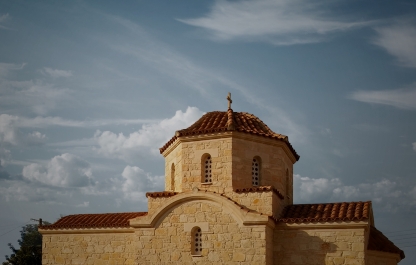
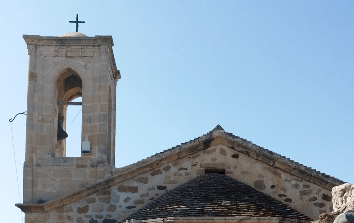
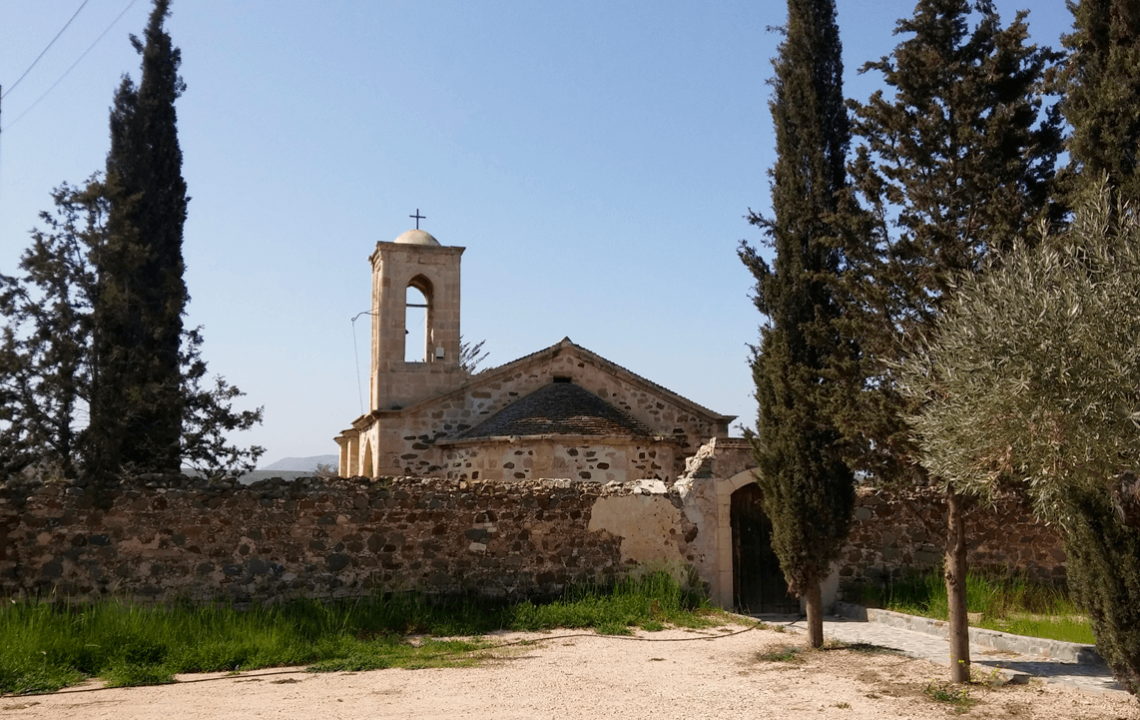
Agios Georgios (Date of Construction — 1911). A classic specimen of a Byzantine church: a stone build, single-naved, with a bell-tower.
The main entrance is flanked on both sides by newly crafted mosaics, made by Constantinos Christou, our old acquaintance and one of the leading Cypriot mosaicists. The images feature Saints Photios and George on shining golden backgrounds (2006). The tympanum above the cornice has been filled with a mosaic of the Saviour.
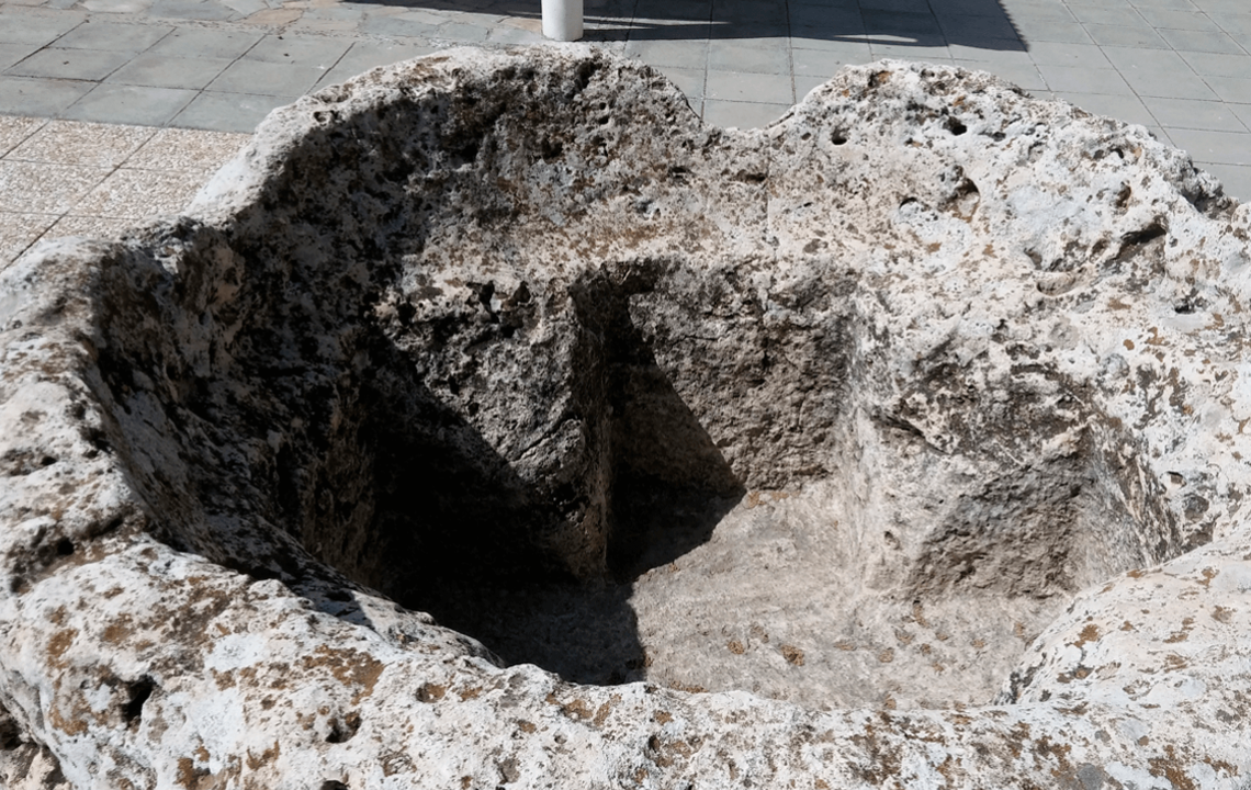
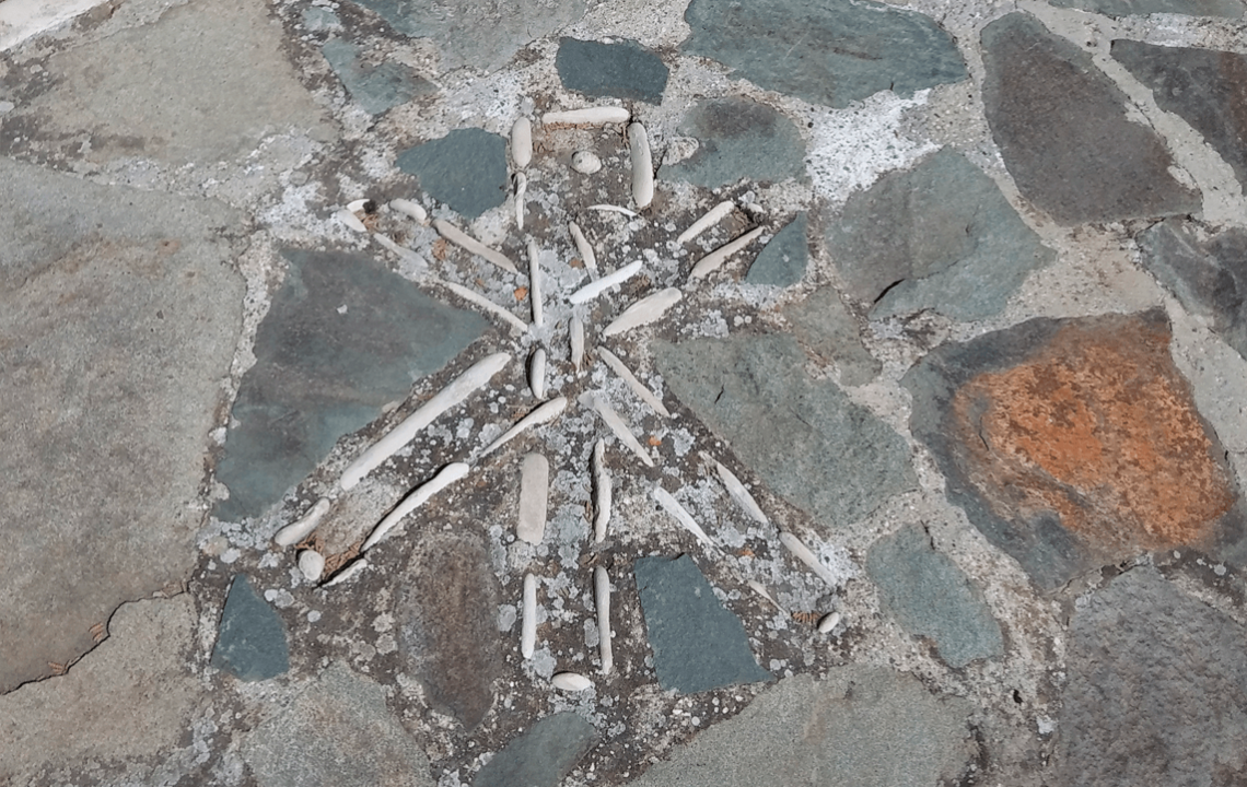
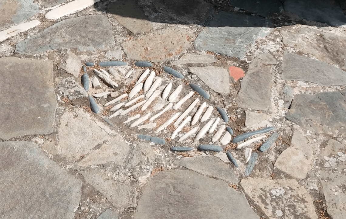
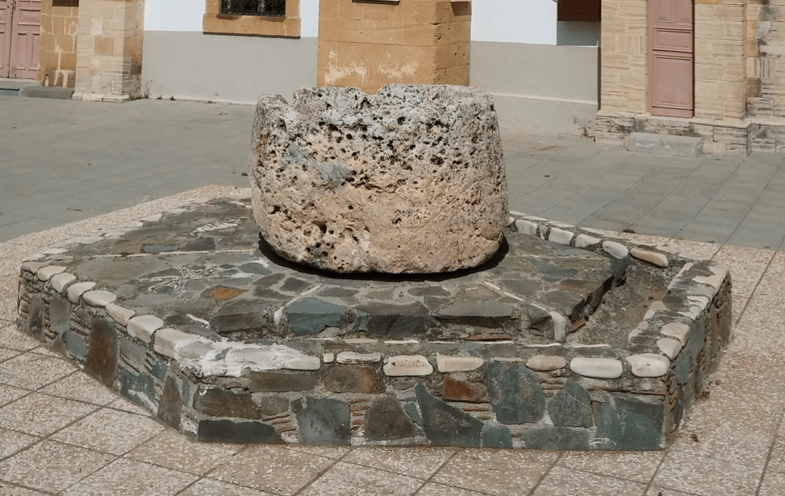
It was closed during our social, albeit, somewhat spontaneous visit. On the bright side, our attention was drawn to a fascinating artefact — an early Christian baptistry, carefully elevated above the square surrounding the church. It’s an ancient sandstone font with a cruciform chalice, standing at a height of 85 cm, with a diameter close to 140 cm. The pedestal has been decorated with a monogram of Jesus Christ and a mosaic image of a fish, also symbolising Him, which was crafted from white and grey sea pebbles.
In his work “The Church of Saint George in Arediou” (released in 2008) Giorgos Panagi, one of the leading Cypriot researchers, estimates the manufacture date of the font, based on the technology used. The author particularly notes the following: “carvings in monolithic boulders were very common in the 6th century. As such, this font dates back roughly to the turn of the V-VI centuries”.
Another researcher, Georgios Karouzis, clarifies that this font used to be situated on one of the hills surrounding the village, where an ancient church once stood. This high ground had the name — “Cross Hill” (Lofos tou Stavrou).
-
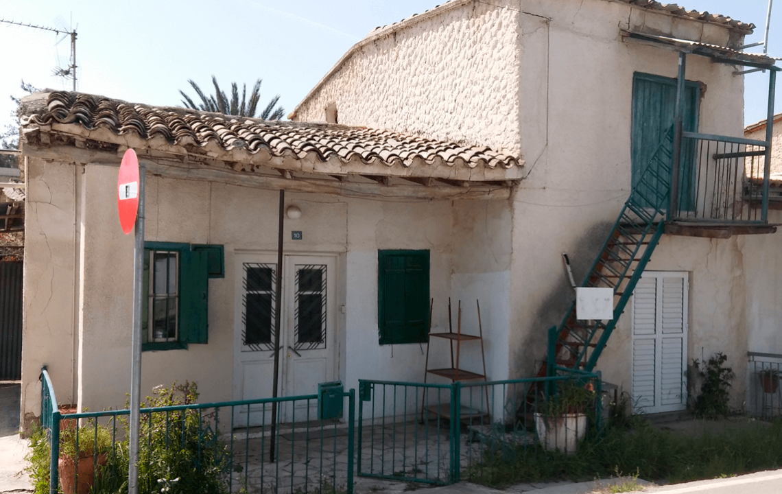
Having finished looking around, we decided to circle the vicinity: down below, along Saint George street, a green expanse, in the low lying area above the river, beckoned us onwards. Some traditional rural homes will grab your attention. You can’t say that the village isn’t developing: the alleyways — alternating with bright green lawns and vacant plots of land overgrown with magnificent cacti — are in a rather good condition. Amongst the thickset, stocky houses, some modern builds have already been erected.
Nature Trail. So, having arrived at this scenic grove, we began to relax a little, in the thick shade by the river bed (as we recall, “rivers” is the name given to the stony beds on the island. Although they are dry for the large part of the year, for merely several weeks annually, a rather strong current of water may rush through them). While enjoying a cool reprieve from the hot midday sun, we feasted our eyes on the thickets, through which you could catch glimpses here and there of new suburban housing.
In fact, good news: it is indicated on the country website (which you can find at the end of this piece) that а pedestrianised nature trail has already begun to be dug out in this idyllic, shady corner. It will lie under the giant eucalyptuses (which appeared from the first years of British rule on the island. Indeed, to top it all off, the Brits were renowned in Cyprus as distinguished landscapers, building roads and inhabited areas of varying sizes). The pathway is under construction along the river channel and will stretch out to 2 km long.
The local authorities have also seen to laying another public park on the village territory.
A curious fact, emphasised by both researchers and locals: not only have these parts preserved vast expanses of lands, which still lie uncultivated (almost 200 km), the region’s wild fauna has even survived, virtually without any changes. As for the natural resources, the most common rock type in Arediou is marl (a clay-like limestone), which has been widely used in construction since the Antiquity.
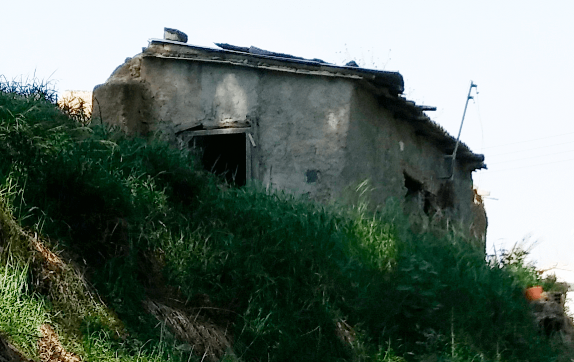
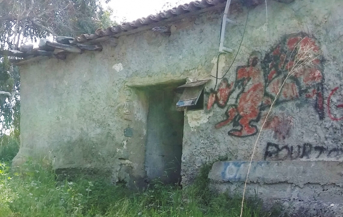
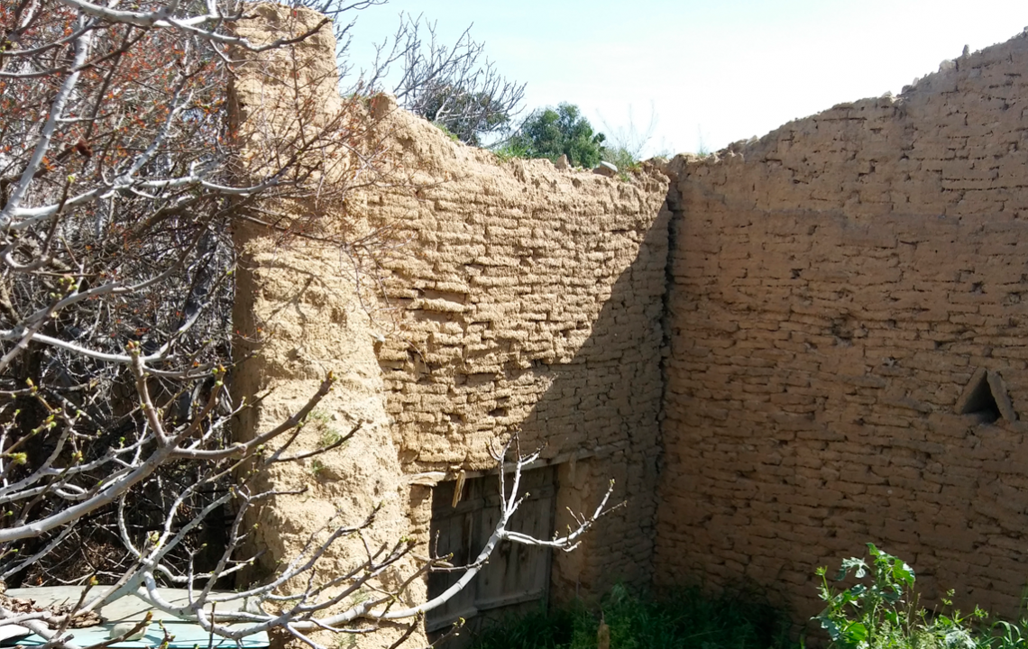
The fate of the island’s “mixed” villages didn’t steer clear of Arediou: the rural homes, left several decades ago by the Turkish-Cypriots, are now dilapidated. Their walls and courtyards become all the more overgrown with bright, bright greenery — after all, life goes on, no matter what!
Naturally, nobody occupies them, and these plots are on an equal footing to the abandoned old builds on the outskirts. Their yellow, adobe brick walls add a specific scenic element to the landscape, and along with this, a slightly sorrowful tint of withering away.
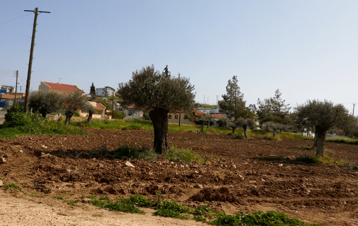
The ancient olive trees growing aplenty in the village vicinity, are a delightful sight…
The Museum of Traditions and Crafts is the next site worth visiting. Lying in an old building, with typical rural-style architecture, it displays to visitors a rather vast collection of objects from everyday life. You can see tools used for agriculture and crafts, as well as samples of furniture and utensils common in all Cypriot villages of the past.
Explanatory information, as such, is absent: what you see is what you get. On the bright side, you can always go to the warden-key keeper for an explanation.
A useful contact (the governing body of Arediou) with regards to visiting the museum, other village sights and so on:
Archbishop Makariou Street, No. 4
Telephone: (+357) 226330080
-
I’d like to share with you what I’ve observed: it’s in the villages where locals reveal their individuality, as they say, “in full”. In the city, when settling into an architecturally planned apartment building, you won’t find that scope for manifesting your own fantasies — the scale just isn’t there. A private premise on the outskirts or in the sticks, however, is a different matter. A rural house, despite it being a project both prepared and implemented by professionals, even if not always original, vividly reflects the personality of its owner — you’ve no need to go to a psychologist!
Another interesting “point” for examination is the garden or even the small front garden which Cypriots have. Due to the population strongly gravitating towards “decorating”, you can also find both a handful of genuinely impressive feats and on the contrary, many utterly hilarious instances. Just keep your eye out for them a little more!
Additional Information and literature on Arediou:
Official Website: www.arediou.com
Karouzis Giorgos. Strolling Around Cyprus, Nicosia, City and District (Nicosia, 2001)
Panagi Georgios. The Church of Agios Georgios Arediou (Nicosia, 2008)
Perdikis Stylianos. An unknown in Cyprus type of old Christian baptismal font, Christian Archaeological Company (Athens, 2003).
-
Albeit rather much at arm’s length, for the time being, getting to know this village turned out to be a pleasant experience. However, let’s not keep ourselves here any longer and press on further.
Malounta
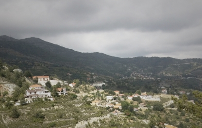
From the Greek: Μαλούντα. This village isn’t big at all (the population totals close to 500 people), with merely several streets sprawled out liberally over the green hills of the Troodos foothills, at a height of 415m above sea level.
The village’s name originated in pre-Christian times: it derives from a word which settlers from Arkadia used about the god Apollo (Μαλούντα Απόλλωνα). In fact, the remains of an ancient settlement and necropolis, lie nearby (between Malounta and the neighbouring Agios Ioannis opposite). This again demonstrably confirms that these spots have been inhabited since the extreme Antiquity.
In the Medieval ages, Malounta was a fiefdom. It was referenced on ancient maps, as well as in the manuscripts of western-European travellers and nobles, under the following names: Melonda and Millondo.
Contemporary Malounta, with its borders today, was formed somewhat later, in the years of Ottoman rule in Cyprus: these places were selected by new landowners who required Cypriot workers to cultivate the lands. Having arrived here, the Cypriots would then form a settlement.
The village, in fact, never became “mixed”.
Interestingly, Malounta is also mentioned in a well-known poem across Cyprus «Η 9η Ιουλίου του 1821 εν Λευκωσία Κύπρου», written by the national poet, Vasilis Michaelides (1849-1917). In it, the village features as the birthplace of the shepherd, Dimitris — one of the main characters.

Nowadays, with support and participation from representatives of the Military forces of Greece and Cyprus (The Hellenic Force in Cyprus, ΕΛΔΥΚ) the rural community has held an annual festival since 1970, in honour of Agios Panigiros (Αγίου Πανηγυρίου). His portable icon is housed in the main church — Panagia Chrisopantanassa (Παναγία Χρυσοπαντάνασσα), a rather large and stunning build (the date “1763” is met in some sources as the year of its construction).
Panagia — one of the local sights — towers on the hill-slope to the left, above the road (later extensions, amongst which a bell tower was included, were crafted from sandstone, while the main body of the church was erected from another type — a cruder, more robust rock from the Troodos). The church also features a faceted apse. On the surrounding square, there is also a rather old Sunday school building (as it’s custom to call here, “A Spiritual Centre” or “Pnevmatisi Estiya”). The core of the village lies higher, as the streets run along the hills in terraces.
Mothers have brought and taken sick children of 1-7 years old into the church, praying to the Virgin Mother for Her to cure them: they say that after a priest has conducted a unique ritual, once three days have passed, many children have been healed after three days passed.
Amongst the other main landmarks in the locality, it’s worth noting: the old church — with the same name — and an ancient bridge under UNESCO protection (it was introduced to the list of world heritage sites in 2002, registered as number 1678).
The “old” Panagia Chrisopantanassa is situated at the exit of Malounta, amongst the village fields and ancient olive trees. You definitely won’t miss it. The church is a very stunning, albeit small stone construction (clearly influenced by Byzantine and Romance architecture), surrounded by the same darkened stone walls — after all, this is a chapel attached to an old churchyard. The church most often remains closed for tourist visits.
From Malounta, we once again exited onto the E904 road and after going back a little, crossed it to move towards another village. On the way there, we encountered the church of Saint Mark (Айос Маркос или Αγίου Μάρκου Ευγενικού). It was constructed in honour of the prelate Mark (1393-1445), a bishop of Constantinople and the metropolitan of Ephesus [1], one of the most prominent spiritual figures of his age.
Agios Ioannis (Lefkosia)
Surrounded by green slopes, the village (judging, seemingly, from the crowded vicinity of neighbouring communities, it is more often called Agios Ioannis Malountas) is sprawled out at a height of 313 m above sea level. It is separated from Nicosia by 18 km, while only 5 km lie between the village and Malounta.
It’s mentioned by Giorgos Karouzis as having the original natural “décor” along the bed of the Akaki (as we already know, a continuation of the Serraxis) — for long years its waters have eroded the marl and clay here, forming a scenic picture. Like in Arediou, the low-lying area was overgrown with wild thickets, amongst which you can encounter eucalyptuses and centuries-old olive trees (according to official data, they are in the region of 35 to 45 thousands years old).
Today’s local administration devotes a lot of attention to supplying services and utilities, as well as developing tourism: aside from the park and playground, there is also a nature trail (since 2007) stretching a total of 4.5 km.
The close neighbour to Malounta has its own landmarks.
The locals, for instance, without fail, recommend visiting the main village church.
Agios Ioannis Prodromos (XIX century) — here you can find an even older, unique icon depicting the Saviour (dating back to the XVI century), while from the outside, the exterior of the building features the rare sculptural image of a lion's head.
An exhibition on local life has opened on the village premises, in one of the old houses. Samples of traditional furniture, as well as ceramic works and the wares of rural needlewomen, have been gathered.
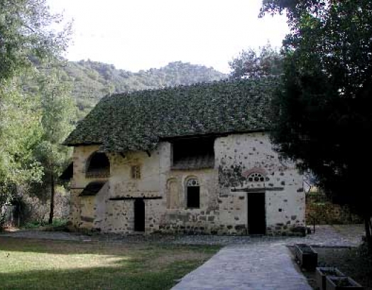
Another landmark in the village vicinity is the watermill — a stone construct lying to the south-west of the village. It has one solid span and a half-span, as well as an aqueduct. The mill is both a genuinely outstanding monument to the past and an impressive landmark. You can get there by turning off the by-road in the vicinity of the hills, on the western side of the Akaki.
Nearby lie the remains of another stone building, probably used for residential purposes, with three arched ceilings and what’s left of a tiled roof on wooden beams — all presumably from the Venetian era.
The simultaneous beauty and sorrow of the old construct ruins can be observed in this video.
")
Well then, you’ve probably had time to tire yourself out, so now as we finish the first part of our journey, this is the time to head, for instance, to the restaurant-tavern “Takkos”.
It’s situated near to Agios Ioannis Prodromos. Telephone: (+357) 22632156
-
Contacts and additional information about the village:
Apostle Andrea Street, No. 1 (The governing body of Agios Ioannis)
Tel: (+357) 22634310
Village Website: www.agiosioannism.org
Email: agioanm.council@cytanet.com.cy
Getting there:
If driving from Nicosia to the villages of Arediou (36 minutes), Malounta and Agios Ioannis (left and right turnings off the main road respectively, 35-40 minute drives) — simply drive along the B9 (continuing onto the E903, also Griva Digeni street) and follow the signs to come off to the left, onto the E904.
By bus: the 100, 157, 250 and 405, routes go there.
Incidentally, the local bus station «Arediou intercity Bus Station» is located on Griva Digeni road (E903), at the entrance to the village. It provides communication between all the close-lying populated points near to the capital (this is No 100, the fare, like for all inter-city routes is 2 euro one-way).
For more details, please see here.
")
Stay with us and until next time!
[1] The prelate Mark Eugenikos, as history informs us, was the only church figure, who in the Greek delegation at the Council of Ferrara-Florence (1438), refused to sign and acknowledge the union of both Churches.
The reason for this was when the Council was in session Mark wrote several theological treatises, which in the course of working on, he came to the conclusion that the doctrines of the Ecumenical councils contradicted the teachings of the Western church.